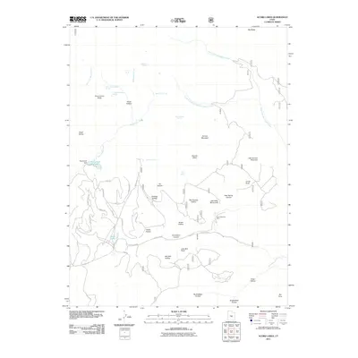
2011 Map of Acord Lakes
USGS Topo · Published 2011About this map
Convulsion Coal Mine sits as a central industrial landmark in this high-altitude landscape of Sevier County, where energy extraction meets a complex network of high-desert drainage systems. The area is defined by the headwaters of North Fork Quitchupah Creek and East Fork Beaver Creek, which carve deep canyons and hollows through the plateau. Notable water management features include the Skutumpah Reservoir, held by the Skutumpah Dam, and the eponymous Acord Lakes to the south. The terrain is marked by numerous springs such as Lizonbee Springs and Anderson Spring, which historically supported livestock and early resource development. A dense network of forest and mountain roads, including Skutumpah Rd and Convulsion Rd, provide access to the rugged ridges and named peaks like Duncan Mountain.
Find a feature on this map
50 named features on this map. Tap any name to fly to it.
Don’t see what you’re looking for? This feature index may not catch every label — zoom into the map to look around manually.
Map Details
Editions of this 2011 Acord Lakes Map
This is the sole edition of this map. No revisions or reprints were ever made.
Other maps of this area

1885 · Manti
USGS Topo · 1:250,000

1885 · Fish Lake
USGS Topo · 1:250,000

1895 · Manti
USGS Topo · 1:250,000

1896 · Fish Lake
USGS Topo · 1:250,000

1922 · Wasatch
USGS Topo · 1:31,680

1925 · Acord Lakes
USGS Topo · 1:62,500

1956 · Salina
USGS Topo · 1:250,000

1956 · Price
USGS Topo · 1:250,000

1960 · Price
USGS Topo · 1:250,000

1960 · Salina
USGS Topo · 1:250,000