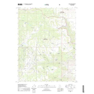
2020 Map of Acord Lakes
USGS Topo · Published 2020About this map
Acord Lakes sit at the center of this high-elevation landscape where the Manti-La Sal National Forest and Fishlake National Forest meet. The geography is defined by the massive Wasatch Plateau and Old Woman Plateau, deeply incised by drainages such as Skutumpah Canyon and Convulsion Canyon. A concentrated network of residential roads, including Roundabout Way and Mountain View East Rd, indicates modern development clustered near the lakes, contrasting with the expansive backcountry of Snow Corral Ridge and White Mtn.
Find a feature on this map
92 named features on this map. Tap any name to fly to it.
Don’t see what you’re looking for? This feature index may not catch every label — zoom into the map to look around manually.
Map Details
Editions of this 2020 Acord Lakes Map
This is the sole edition of this map. No revisions or reprints were ever made.
Other maps of this area

1885 · Manti
USGS Topo · 1:250,000

1885 · Fish Lake
USGS Topo · 1:250,000

1895 · Manti
USGS Topo · 1:250,000

1896 · Fish Lake
USGS Topo · 1:250,000

1922 · Wasatch
USGS Topo · 1:31,680

1925 · Acord Lakes
USGS Topo · 1:62,500

1956 · Salina
USGS Topo · 1:250,000

1956 · Price
USGS Topo · 1:250,000

1960 · Price
USGS Topo · 1:250,000

1960 · Salina
USGS Topo · 1:250,000