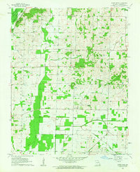
1962 Map of Acorn Ridge
USGS Topo · Published 1963About this map
Mingo National Wildlife Refuge dominates the northwestern corner of this Stoddard County landscape, where the edge of the Mingo Swamp meets the low hills of New Lisbon and Castor. The map illustrates a complex drainage network vital to local agriculture, including Lick Creek Ditch and Ditch No 1, which channel water away from the bottomlands toward the Castor River. Small settlements like Acorn Ridge and Curdton serve as local hubs, connected by a grid of rural roads and the tracks of the St Louis San Francisco railroad.
Find a feature on this map
33 named features on this map. Tap any name to fly to it.
Don’t see what you’re looking for? This feature index may not catch every label — zoom into the map to look around manually.
Map Details
Editions of this 1962 Acorn Ridge Map
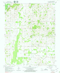
2 editions found
Other maps of this area

1934 · Bloomfield
USGS Topo · 1:62,500

1934 · Advance
USGS Topo · 1:62,500

1934 · Puxico
USGS Topo · 1:62,500

1935 · Zalma
USGS Topo · 1:62,500

1939 · Bloomfield
USGS Topo · 1:62,500

1939 · Advance
USGS Topo · 1:62,500

1939 · Puxico
USGS Topo · 1:62,500

1939 · Zalma
USGS Topo · 1:62,500

1949 · Paducah
USGS Topo · 1:250,000

1949 · Rolla
USGS Topo · 1:250,000