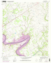
1961 Map of Acton
USGS Topo · Published 1979About this map
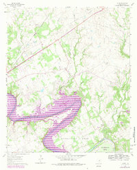
Brazos River meanders through this portion of Hood County, characterized by the dramatic loops of Walters Bend, Carmichael Bend, and De Cordova Bend. The landscape shows a significant transition with the introduction of Lake Granbury, shown here in purple revisions from the late 1970s. This reservoir altered the local geography, submerging sections of the river valley while preserving the surrounding agricultural and recreational character. Settlements like Acton and Waples are central to the map's historical interest, particularly with the inclusion of Acton State Park, the state's smallest park and burial site of Elizabeth Crocker Crockett. Transportation and youth development are prominent, with the Gulf Colorado and Santa Fe railroad cutting across the northern reaches and established camps such as Camp Leonard and El Tesoro occupying the riverfront bluffs.
Find a feature on this map
32 named features on this map. Tap any name to fly to it.
Don’t see what you’re looking for? This feature index may not catch every label — zoom into the map to look around manually.
Map Details
Editions of this 1961 Acton Map
5 editions found
Other maps of this area

1889 · Granbury
USGS Topo · 1:125,000

1891 · Weatherford
USGS Topo · 1:125,000

1893 · Weatherford
USGS Topo · 1:125,000

1923 · Granbury 2-a
USGS Topo · 1:48,000

1923 · Granbury 1-b
USGS Topo · 1:48,000

1924 · Weatherford 3-d
USGS Topo · 1:48,000

1924 · Granbury 1-c
USGS Topo · 1:48,000

1928 · Godley
USGS Topo · 1:62,500

1931 · Dennis
USGS Topo · 1:62,500

1931 · Tolar
USGS Topo · 1:62,500