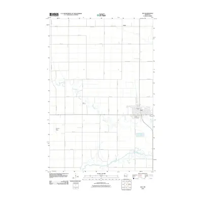
2010 Map of Ada
USGS Topo · Published 2010About this map
Ada serves as the focal point of this western Minnesota landscape, situated at the junction of several county highways and the rail corridor. The town layout is clearly defined, featuring the Ada Post Office, the Norman County Fairgrounds, and the Ada Cemetery on its eastern edge. North of the city, the small settlement of Hadler sits near the northern boundary, illustrating the typical spaced-interval development of rural prairie communities along transportation routes.
Find a feature on this map
33 named features on this map. Tap any name to fly to it.
Don’t see what you’re looking for? This feature index may not catch every label — zoom into the map to look around manually.
Map Details
Editions of this 2010 Ada Map
This is the sole edition of this map. No revisions or reprints were ever made.
Other maps of this area

1918 · Twin Valley
USGS Topo · 1:62,500

1918 · Ulen
USGS Topo · 1:62,500

1924 · Ada
USGS Topo · 1:62,500

1952 · Grand Forks
USGS Topo · 1:250,000

1956 · Grand Forks
USGS Topo · 1:250,000

1965 · Lockhart
USGS Topo · 1:24,000

1965 · Anthony
USGS Topo · 1:24,000
1965 · Ada NW
USGS Topo · 1:24,000

1965 · Twin Valley SW
USGS Topo · 1:24,000

1965 · Twin Valley NW
USGS Topo · 1:24,000