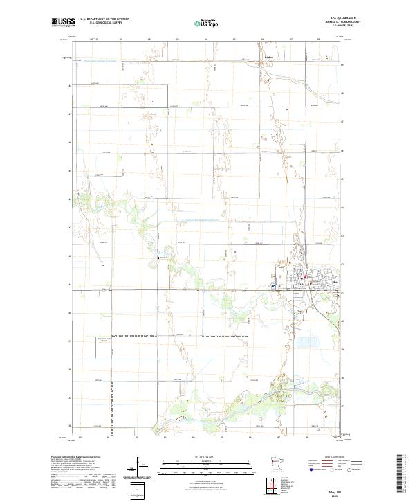
2022 Map of Ada
USGS Topo · Published 2022About this map
The city of Ada serves as a focal point for Norman County, organized around a grid of residential and commercial streets such as W Main St and E Main St. The civic heart of the community is anchored by the Norman County Courthouse, with Ada Cem situated on the eastern edge of the settlement. The surrounding landscape is characterized by a sophisticated network of agricultural drainage and water management, featuring substantial works like State Ditch Number Sixty-eight and Judicial Ditch Number Fiftyone. These engineered waterways complement the natural meandering paths of the Wild Rice River and Marsh River, which snake through the western and southern reaches of the quadrangle. Smaller landmarks, such as Hadler to the north and the Hammars Farm Airport to the southwest, reflect the area's rural aviation and transport ties.
Find a feature on this map
56 named features on this map. Tap any name to fly to it.
Don’t see what you’re looking for? This feature index may not catch every label — zoom into the map to look around manually.
Map Details
Editions of this 2022 Ada Map
This is the sole edition of this map. No revisions or reprints were ever made.
Other maps of this area

1918 · Twin Valley
USGS Topo · 1:62,500

1918 · Ulen
USGS Topo · 1:62,500

1924 · Ada
USGS Topo · 1:62,500

1952 · Grand Forks
USGS Topo · 1:250,000

1956 · Grand Forks
USGS Topo · 1:250,000

1965 · Lockhart
USGS Topo · 1:24,000

1965 · Anthony
USGS Topo · 1:24,000
1965 · Ada NW
USGS Topo · 1:24,000

1965 · Twin Valley SW
USGS Topo · 1:24,000

1965 · Twin Valley NW
USGS Topo · 1:24,000