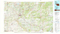
1990 Map of Ada
USGS Topo · Published 1990About this map
Ada serves as the primary hub of this landscape, its urban grid situated at the junction of the Atchison Topeka and Santa Fe RR and several regional roads. As the home of East Central State University, the city anchors a region defined by a transition from the agricultural plains to the more varied terrain of the Chickasaw Nat Rec Area near Sulphur. The serpentine Canadian River forms the northern boundary, while man-made features like Lake Konawa and the Atoka Reservoir indicate the mid-century development of water resources across South Central Oklahoma.
Find a feature on this map
61 named features on this map. Tap any name to fly to it.
Don’t see what you’re looking for? This feature index may not catch every label — zoom into the map to look around manually.
Map Details
Editions of this 1990 Ada Map
This is the sole edition of this map. No revisions or reprints were ever made.
Other maps of this area

1896 · Seminole and Prague
USGS Topo · 1:125,000

1896 · Coalgate
USGS Topo · 1:125,000

1898 · Purcell
USGS Topo · 1:125,000

1898 · McAlester
USGS Topo · 1:125,000

1898 · Pauls Valley
USGS Topo · 1:125,000

1899 · Coalgate
USGS Topo · 1:125,000

1899 · Atoka
USGS Topo · 1:125,000

1900 · Canadian
USGS Topo · 1:125,000

1900 · Wewoka
USGS Topo · 1:125,000

1900 · Atoka
USGS Topo · 1:125,000