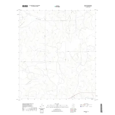
2019 Map of Adams NW
USGS Topo · Published 2019About this map
South Concho Draw and Milligan Draw define the drainage patterns across this section of the Edwards Plateau in Schleicher County. The landscape is characterized by its distinct topographic depressions and elevations, including Live Oak Hollow and the broader expanse of North Valley to the southeast. This 2019 survey reflects a sparse, rural environment where the primary markers of human presence are the section-line roads and ranch connectors such as Co RD 316, Co RD 300, and Co RD 350. The map captures the subtle hydrography of the region, specifically where the N Valley Prong begins its course. It is an essential document for understanding contemporary land use and the enduring physical geography of the Texas backcountry.
Find a feature on this map
9 named features on this map. Tap any name to fly to it.
Don’t see what you’re looking for? This feature index may not catch every label — zoom into the map to look around manually.
Map Details
Editions of this 2019 Adams NW Map
This is the sole edition of this map. No revisions or reprints were ever made.
Other maps of this area

1892 · San Angelo
USGS Topo · 1:125,000

1893 · Fort McKavett
USGS Topo · 1:125,000

1895 · Sherwood
USGS Topo · 1:125,000

1954 · Sonora
USGS Topo · 1:250,000

1954 · San Angelo
USGS Topo · 1:250,000

1958 · Sonora
USGS Topo · 1:250,000

1958 · San Angelo
USGS Topo · 1:250,000

1963 · Adams
USGS Topo · 1:24,000

1963 · Adams NW
USGS Topo · 1:24,000

1963 · Adams SE
USGS Topo · 1:24,000