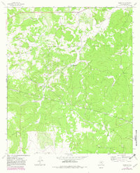
1963 Map of Adams SW
USGS Topo · Published 1982About this map
The Koy Ranch and Hendrick Ranch define the settlement pattern of this West Texas ranching landscape, which was updated by the U.S. Geological Survey through 1979 aerial photography. The terrain is characterized by a series of drainages, most notably Live Oak Hollow and North Valley, which converge as they move through the quadrangle. A significant local landmark, the Twentymile Waterhole, serves as a critical water source in an area otherwise marked by ephemeral features and scattered Gravel Pits.
Find a feature on this map
15 named features on this map. Tap any name to fly to it.
Don’t see what you’re looking for? This feature index may not catch every label — zoom into the map to look around manually.
Map Details
Editions of this 1963 Adams SW Map
2 editions found
Other maps of this area

1893 · Fort McKavett
USGS Topo · 1:125,000

1954 · Sonora
USGS Topo · 1:250,000

1958 · Sonora
USGS Topo · 1:250,000

1963 · Buffalo Well
USGS Topo · 1:24,000

1963 · Buffalo Well NW
USGS Topo · 1:24,000

1963 · Adams
USGS Topo · 1:24,000

1963 · Adams NW
USGS Topo · 1:24,000

1963 · Adams SE
USGS Topo · 1:24,000

1963 · Adams SW
USGS Topo · 1:24,000

1964 · Sonora NE
USGS Topo · 1:24,000