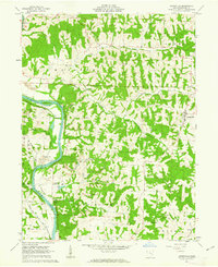
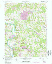
1962 Map of Adamsville
USGS Topo · Published 1963About this map
The Muskingum River dominates this early 1960s survey, flowing past islands like Copeland I and Jackson I while supporting a network of riverside industry and transit. Two major rail lines, the Pennsylvania and the New York Chicago and St Louis, track the river's path, serving small riverside settlements such as Ellis, Gilbert, and Drake. This period of Ohio's history is marked by a landscape of extraction, evidenced by numerous strip mines and scattered gas wells throughout the eastern hills of the Salem and Madison townships.
Find a feature on this map
42 named features on this map. Tap any name to fly to it.
Don’t see what you’re looking for? This feature index may not catch every label — zoom into the map to look around manually.
Map Details
Editions of this 1962 Adamsville Map
5 editions found
Other maps of this area

1908 · Conesville
USGS Topo · 1:62,500

1910 · Frazeysburg
USGS Topo · 1:62,500

1910 · Philo
USGS Topo · 1:62,500

1910 · Zanesville
USGS Topo · 1:62,500

1910 · Conesville
USGS Topo · 1:62,500

1947 · Columbus
USGS Topo · 1:250,000

1949 · Clarksburg
USGS Topo · 1:250,000

1950 · Marion
USGS Topo · 1:250,000

1951 · Canton
USGS Topo · 1:250,000

1953 · Canton
USGS Topo · 1:250,000