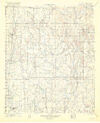
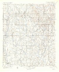
1901 Map of Addington
USGS Topo · Published 1916About this map
The Indian Territory Oklahoma Boundary Line bisects this late 19th-century landscape, capturing a pivotal moment before Oklahoma achieved statehood. Central to the region's economy and movement is the legendary Chisholm Trail, running north-south through the Chickasaw Nation. This historic cattle route is mirrored by the Chicago Rock Island and Pacific Ry, which connects cattle-shipping centers like Addington and its associated Stock Yards.
Find a feature on this map
109 named features on this map. Tap any name to fly to it.
Don’t see what you’re looking for? This feature index may not catch every label — zoom into the map to look around manually.
Map Details
Editions of this 1901 Addington Map
6 editions found
Other maps of this area

1898 · Pauls Valley
USGS Topo · 1:125,000

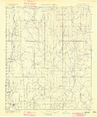
1901 · Addington
USGS Topo · 1:125,000

1901 · Ardmore
USGS Topo · 1:125,000

1902 · Gainesville
USGS Topo · 1:125,000

1902 · Pauls Valley
USGS Topo · 1:125,000

1902 · Rush Springs
USGS Topo · 1:125,000

1905 · Montague
USGS Topo · 1:125,000

1918 · Ardmore
USGS Topo · 1:125,000

1943 · Gainesville
USGS Topo · 1:125,000

1949 · Nellie
USGS Topo · 1:62,500