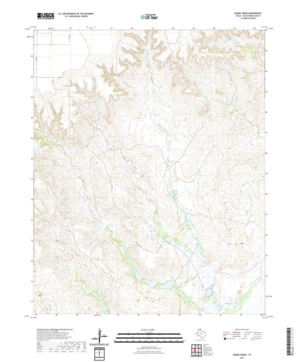
2022 Map of Adobe Creek
USGS Topo · Published 2022About this map
Adobe Creek and its southern tributaries dominate this section of the Texas Panhandle in Hutchinson County, where the high plains break into a network of draws and seasonal watercourses. The landscape is defined by the winding paths of Bent Creek and the W Fork Johns Cr, which have carved intricate drainage patterns through the local topography. This 2022 survey captures a rural environment primarily organized around the county road grid, with routes like Co RD 22 and Co RD 23 providing the primary access across the rugged breaks. The interplay between the drainage of Adobe Cr and Bent Cr reflects the classic erosional character of this region, where water-carved valleys are the primary landmarks in an otherwise open ranching or agricultural expanse.
Find a feature on this map
9 named features on this map. Tap any name to fly to it.
Don’t see what you’re looking for? This feature index may not catch every label — zoom into the map to look around manually.
Map Details
Editions of this 2022 Adobe Creek Map
This is the sole edition of this map. No revisions or reprints were ever made.
Other maps of this area

1953 · Plemons
USGS Topo · 1:24,000

1953 · Stinnett Station
USGS Topo · 1:24,000

1954 · Perryton
USGS Topo · 1:250,000

1954 · Amarillo
USGS Topo · 1:250,000

1958 · Perryton
USGS Topo · 1:250,000

1958 · Amarillo
USGS Topo · 1:250,000

1971 · Adobe Creek SW
USGS Topo · 1:24,000

1971 · Garden Springs
USGS Topo · 1:24,000

1971 · Adobe Creek SE
USGS Topo · 1:24,000

1973 · Spearman SE
USGS Topo · 1:24,000