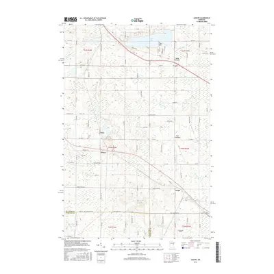
2016 Map of Adolph
USGS Topo · Published 2016About this map
The Saint Louis River and Midway River define the southern reaches of this landscape as it appeared in 2016, where the rural topography meets the edge of the Saint Louis and Carlton County line. Small nodes of settlement like Adolph and Munger sit along the corridors of Old Hwy 2, illustrating the enduring importance of historical transport routes. Further north, the residential developments around Pike Lake and its distinctive Ne-i-ash-i Point contrast with the more sparsely settled wetlands near Mud Lake and Horseshoe Lake. Local history is anchored by sites like Canosia Cem and Solway Cem, while the Lennartson Airport serves as a modern landmark in the south. The map documents a network of local roads such as Munger Shaw Rd and Caribou Lake Rd that connect the intersecting neighborhoods of Four Corners and Five Corners.
Find a feature on this map
88 named features on this map. Tap any name to fly to it.
Don’t see what you’re looking for? This feature index may not catch every label — zoom into the map to look around manually.
Map Details
Editions of this 2016 Adolph Map
This is the sole edition of this map. No revisions or reprints were ever made.
Other maps of this area

1895 · Duluth
USGS Topo · 1:62,500

1915 · Superior
USGS Topo · 1:48,000

1917 · Superior
USGS Topo · 1:62,500

1953 · Twig
USGS Topo · 1:24,000

1953 · Saginaw
USGS Topo · 1:24,000

1953 · Adolph
USGS Topo · 1:24,000

1953 · Duluth Heights
USGS Topo · 1:24,000

1953 · Fredenberg
USGS Topo · 1:24,000

1953 · Independence
USGS Topo · 1:24,000

1953 · Duluth
USGS Topo · 1:62,500