
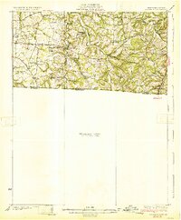
1931 Map of Adolphus
USGS Topo · Published 1931About this map
River crossings and rural education centers define this borderland landscape between Kentucky and Tennessee in the late 1920s. Before the development of modern bridges, transit across the Middle Fork and Trammel Fork relied on established river points like Old Mill Ford and Borens Ford. These crossings connected a network of small agricultural hubs such as New Roe, Adolphus, and Rapids. The map reveals a high density of one-room schoolhouses and country churches that served as the social backbone for farming families, including Rocky Hill Sch, Cave Spring Sch, and McKendree Chapel.
Find a feature on this map
50 named features on this map. Tap any name to fly to it.
Don’t see what you’re looking for? This feature index may not catch every label — zoom into the map to look around manually.
Map Details
Editions of this 1931 Adolphus Map
2 editions found
Other maps of this area

1903 · Nashville
USGS Topo · 1:125,000

1921 · Bowling Green
USGS Topo · 1:62,500

1923 · Bowling Green
USGS Topo · 1:62,500

1926 · Scottsville
USGS Topo · 1:62,500

1928 · Adolphus
USGS Topo · 1:48,000

1931 · Lafayette
USGS Topo · 1:62,500

1942 · Gallatin
USGS Topo · 1:100,000

1951 · Woodburn
USGS Topo · 1:24,000

1951 · Franklin
USGS Topo · 1:24,000

1953 · Cottontown
USGS Topo · 1:24,000