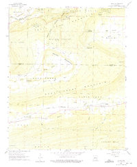
1961 Map of Adona
USGS Topo · Published 1975About this map
The Petit Jean River winds through the northern portion of this landscape, carving through Carden Bottom as it flows past the high plateau of Petit Jean Mountain. This area is home to Petit Jean State Park, featuring notable landmarks like Rock House Cave, Needle Eye, and Lookout Point. The transition from the rugged mountain heights to the flatter Ada Valley reveals a 1960s agricultural and residential pattern, with small settlements like Ada and Adona situated along the lower terrain.
Find a feature on this map
43 named features on this map. Tap any name to fly to it.
Don’t see what you’re looking for? This feature index may not catch every label — zoom into the map to look around manually.
Map Details
Editions of this 1961 Adona Map
3 editions found

Other maps of this area

1888 · Dardanelle #4
USGS Topo · 1:62,500

1889 · Morrilton No. 3
USGS Topo · 1:62,500

1890 · Benton
USGS Topo · 1:125,000

1890 · Hot Springs
USGS Topo · 1:125,000

1890 · Dardanelle
USGS Topo · 1:125,000

1892 · Morrillton
USGS Topo · 1:125,000

1894 · Morrillton
USGS Topo · 1:125,000

1894 · Hot Springs
USGS Topo · 1:125,000

1894 · Benton
USGS Topo · 1:125,000

1955 · Little Rock
USGS Topo · 1:250,000