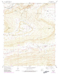
1961 Map of Adona
USGS Topo · Published 1984About this map
Petit Jean Mountain dominates the northern landscape of this Arkansas survey, where the bluffs and overlooks of Petit Jean State Park meet the valley of Petit Jean Creek. The map documents a rugged transition zone between the high plateau, home to geologic landmarks like Rock House Cave and Needle Eye, and the agricultural lowlands of Carden Bottom. In the south, the community of Adona serves as a local hub near Rocky Cypress Creek, surrounded by small family-named cemeteries and rural churches. The presence of a Shale Pit and Gravel Pit near Rose Creek indicates the localized extraction industry common in the mid-century Arkansas River Valley. The terrain is deeply etched by a network of drainage ways including Little Rose Creek and Mulberry Creek, which separate Round Mountain from the main ridge at Sharps Gap.
Find a feature on this map
40 named features on this map. Tap any name to fly to it.
Don’t see what you’re looking for? This feature index may not catch every label — zoom into the map to look around manually.
Map Details
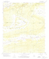
Editions of this 1961 Adona Map
3 editions found

Other maps of this area

1888 · Dardanelle #4
USGS Topo · 1:62,500

1889 · Morrilton No. 3
USGS Topo · 1:62,500

1890 · Benton
USGS Topo · 1:125,000

1890 · Hot Springs
USGS Topo · 1:125,000

1890 · Dardanelle
USGS Topo · 1:125,000

1892 · Morrillton
USGS Topo · 1:125,000

1894 · Morrillton
USGS Topo · 1:125,000

1894 · Hot Springs
USGS Topo · 1:125,000

1894 · Benton
USGS Topo · 1:125,000

1955 · Little Rock
USGS Topo · 1:250,000