
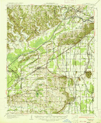
1934 Map of Advance
USGS Topo · Published 1934About this map
Advance sits at the heart of this Missouri survey, which illustrates a landscape defined by significant drainage engineering and rail connections in the 1930s. The Headwater Diversion Channel and Diversion Channel cut across the terrain, reflecting the massive efforts to manage the Whitewater River and Castor River basins. To the east, the St Louis Southwestern railroad links rural stops like Randles, Perkins, and Messler, while the St Louis - San Francisco line passes through Ardeola and Bell City.
Find a feature on this map
80 named features on this map. Tap any name to fly to it.
Don’t see what you’re looking for? This feature index may not catch every label — zoom into the map to look around manually.
Map Details
Editions of this 1934 Advance Map
3 editions found
Other maps of this area

1922 · Cape Girardeau
USGS Topo · 1:62,500

1924 · Cape Girardeau
USGS Topo · 1:62,500

1931 · Sikeston
USGS Topo · 1:62,500

1933 · Marble Hill
USGS Topo · 1:62,500

1933 · Marquand
USGS Topo · 1:62,500

1934 · Morley
USGS Topo · 1:62,500

1934 · Bloomfield
USGS Topo · 1:62,500

1934 · Sikeston
USGS Topo · 1:62,500

1934 · Puxico
USGS Topo · 1:62,500

1935 · Zalma
USGS Topo · 1:62,500