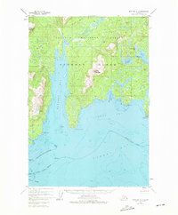
1952 Map of Afognak A-2
USGS Topo · Published 1976About this map
Chugach National Forest encompasses the northern reaches of this coastal Alaskan landscape, where the jagged shoreline of Afognak Island meets the waters of Marmot Bay. The map documents a highly specialized maritime infrastructure in the mid-20th century, specifically the Hatchery Seaplane Landing Area on the eastern coast near Kitoi Bay. This facility, situated between Big Kitoi Lake and the salt water, indicates the intersection of early aviation and fisheries management in this remote region.
Find a feature on this map
25 named features on this map. Tap any name to fly to it.
Don’t see what you’re looking for? This feature index may not catch every label — zoom into the map to look around manually.
Map Details
Editions of this 1952 Afognak A-2 Map
2 editions found

Other maps of this area

1947 · Kodiak D-3
USGS Topo · 1:63,360

1949 · Kodiak D-2
USGS Topo · 1:63,360

1949 · Kodiak D-3
USGS Topo · 1:63,360

1949 · Kodiak D-1
USGS Topo · 1:63,360

1950 · Kodiak D-3
USGS Topo · 1:63,360

1951 · Kodiak D-1
USGS Topo · 1:63,360

1951 · Kodiak D-2
USGS Topo · 1:63,360

1952 · Kodiak
USGS Topo · 1:250,000

1952 · Afognak
USGS Topo · 1:250,000

1952 · Afognak A-3
USGS Topo · 1:63,360