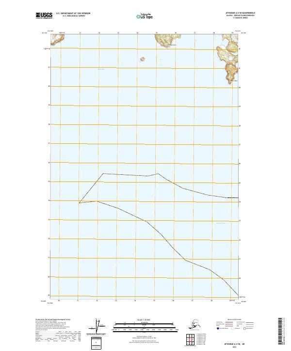
2021 Map of Afognak A-2 SE
USGS Topo · Published 2021About this map
Cape Izhut and Selezen Point define the coastal edges of this maritime landscape on Kodiak Island, where the island's jagged shoreline meets the North Pacific. The terrain is marked by the interface of Duck Bay to the north and the expansive Marmot Bay to the south. This coastal region remains largely undeveloped, characterized by its complex hydrography and high-elevation contours. The survey details the township and range boundaries of T24S and T25S, providing a precise spatial record of the Public Land Survey System as it overlays these remote Alaskan waters and points. Researchers focusing on the Gulf of Alaska will find the exact coordinates and shoreline morphology of these navigational landmarks valuable for tracking coastal change or identifying specific marine access points.
Find a feature on this map
8 named features on this map. Tap any name to fly to it.
Don’t see what you’re looking for? This feature index may not catch every label — zoom into the map to look around manually.
Map Details
Editions of this 2021 Afognak A-2 SE Map
This is the sole edition of this map. No revisions or reprints were ever made.
Other maps of this area

1949 · Kodiak D-2
USGS Topo · 1:63,360

1949 · Kodiak D-1
USGS Topo · 1:63,360

1951 · Kodiak D-1
USGS Topo · 1:63,360

1951 · Kodiak D-2
USGS Topo · 1:63,360

1952 · Kodiak
USGS Topo · 1:250,000

1952 · Afognak
USGS Topo · 1:250,000

1952 · Afognak A-1
USGS Topo · 1:63,360

1952 · Afognak A-2
USGS Topo · 1:63,360
1953 · Afognak A-1
USGS Topo · 1:63,360
1954 · Afognak A-2
USGS Topo · 1:63,360