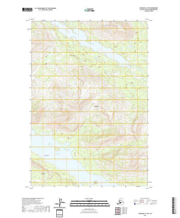
2021 Map of Afognak A-3 SW
USGS Topo · Published 2021About this map
Aleneva stands as the primary human settlement in this maritime landscape, positioned on the eastern shore of Afognak Lake where the terrain descends toward the coastal inlets. This coastal reach of the Kodiak Archipelago is defined by deep maritime indentations, including Yukuk Bay and Waskanareska Bay, which are separated from Raspberry Island by the waters of Raspberry Strait. The hydrologic network is dominated by the short, vital runs of the Afognak River and Hatchery Cr, which drain the interior highlands toward the Pacific.
Find a feature on this map
17 named features on this map. Tap any name to fly to it.
Don’t see what you’re looking for? This feature index may not catch every label — zoom into the map to look around manually.
Map Details
Editions of this 2021 Afognak A-3 SW Map
This is the sole edition of this map. No revisions or reprints were ever made.
Other maps of this area

1947 · Kodiak D-3
USGS Topo · 1:63,360

1949 · Kodiak D-3
USGS Topo · 1:63,360

1950 · Kodiak D-3
USGS Topo · 1:63,360

1952 · Kodiak
USGS Topo · 1:250,000

1952 · Afognak
USGS Topo · 1:250,000

1952 · Afognak A-4
USGS Topo · 1:63,360

1952 · Afognak A-3
USGS Topo · 1:63,360

1952 · Kodiak D-4
USGS Topo · 1:63,360

1953 · Afognak A-4
USGS Topo · 1:63,360
1954 · Afognak A-3
USGS Topo · 1:63,360