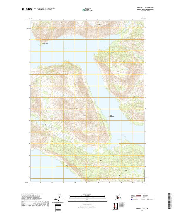
2021 Map of Afognak A-4 SE
USGS Topo · Published 2021About this map
Port Wakefield sits at the narrowest point of the coastline on this island survey, positioned between the steep elevations of Mt Lowell Wakefield and the protected waters of the channel. The landscape is defined by its dramatic maritime topography, where the waters of Raspberry Strait separate landmasses and create a series of sheltered inlets including Muskomee Bay and Selief Bay. This coastal geography necessitated a reliance on sea-based transport and fishing, as evidenced by the strategic location of the settlement and the various named points and peaks like Dolphin Point and Godfrey Mtn. The map provides a precise layout of the shoreline and elevation contours that dictated the expansion of local infrastructure during this period of the twenty-first century.
Find a feature on this map
11 named features on this map. Tap any name to fly to it.
Don’t see what you’re looking for? This feature index may not catch every label — zoom into the map to look around manually.
Map Details
Editions of this 2021 Afognak A-4 SE Map
This is the sole edition of this map. No revisions or reprints were ever made.
Other maps of this area

1947 · Kodiak D-3
USGS Topo · 1:63,360

1949 · Kodiak D-3
USGS Topo · 1:63,360

1950 · Kodiak D-3
USGS Topo · 1:63,360

1952 · Kodiak
USGS Topo · 1:250,000

1952 · Afognak
USGS Topo · 1:250,000

1952 · Afognak A-4
USGS Topo · 1:63,360

1952 · Afognak A-3
USGS Topo · 1:63,360

1952 · Kodiak D-4
USGS Topo · 1:63,360

1953 · Afognak A-4
USGS Topo · 1:63,360
1954 · Afognak A-3
USGS Topo · 1:63,360