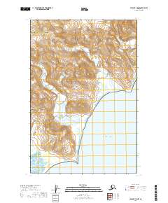
2019 Map of Afognak C-5 NW
USGS Topo · Published 2019About this map
Katmai National Park encompasses a significant portion of this coastal landscape along the Pacific Ocean, where the rugged topography of the Alaskan peninsula meets the sea. The 2019 survey delineates the boundary between the Kodiak Island Borough and the Kenai Peninsula Borough, marking a remote intersection of administrative jurisdictions. The terrain is characterized by steep elevation changes and coastal inlets, typical of the Shelikof Strait region. Without established roads or permanent settlements printed on the map, the data focuses on the natural hydrology and the preservation of this protected wilderness area. This sheet serves as a primary record of the shoreline and internal borough lines as they existed in the early 21st century.
Find a feature on this map
9 named features on this map. Tap any name to fly to it.
Don’t see what you’re looking for? This feature index may not catch every label — zoom into the map to look around manually.
Map Details
Editions of this 2019 Afognak C-5 NW Map
This is the sole edition of this map. No revisions or reprints were ever made.
Other maps of this area

1951 · Afognak C-6
USGS Topo · 1:63,360
1951 · Afognak C-5
USGS Topo · 1:63,360

1951 · Afognak D-5
USGS Topo · 1:63,360

1951 · Afognak D-6
USGS Topo · 1:63,360

1952 · Afognak
USGS Topo · 1:250,000
1983 · Afognak D-6
USGS Topo · 1:63,360
2019 · Afognak C-5 NE
USGS Topo · 1:25,000
2019 · Afognak D-6 SE
USGS Topo · 1:25,000
2019 · Afognak C-6 NE
USGS Topo · 1:25,000
2019 · Afognak D-5 SE
USGS Topo · 1:25,000