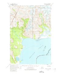
1951 Map of Afognak C-6
USGS Topo · Published 1974About this map
The Katmai National Monument boundary stretches across this coastal landscape, revealing the transition from the mountainous interior to the waters of the Shelikof Strait. During this era of mid-century mapping, the document records two primary human outposts that had already slipped into the past, marked as Kaguyak (Aban'd) and Swikshak (Aban'd). These sites represent the difficult balance of life on the edge of the Alaska Peninsula, where the Big River and Swikshak River flow through glacial valleys into the sea.
Find a feature on this map
15 named features on this map. Tap any name to fly to it.
Don’t see what you’re looking for? This feature index may not catch every label — zoom into the map to look around manually.
Map Details
Editions of this 1951 Afognak C-6 Map
2 editions found
Other maps of this area

1948 · Mt Katmai
USGS Topo · 1:250,000

1951 · Mt Katmai
USGS Topo · 1:250,000

1951 · Afognak C-6
USGS Topo · 1:63,360
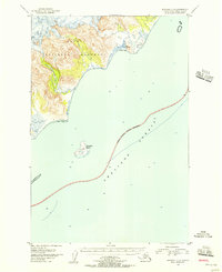
1951 · Afognak C-5
USGS Topo · 1:63,360

1951 · Mount Katmai D-1
USGS Topo · 1:63,360

1951 · Mount Katmai C-1
USGS Topo · 1:63,360

1951 · Mount Katmai B-1
USGS Topo · 1:63,360

1951 · Afognak D-5
USGS Topo · 1:63,360

1951 · Afognak D-6
USGS Topo · 1:63,360

1952 · Afognak
USGS Topo · 1:250,000