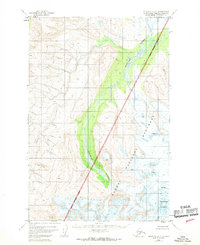
1951 Map of Afognak D-6
USGS Topo · Published 1968About this map
Douglas River winds through the central valley of this 1951 survey, serving as a primary drainage for the surrounding peaks. The landscape is defined by the proximity of the Katmai National Monument Boundary, which bisects the quadrangle along a diagonal line, separating the monument from the rest of the Kenai Peninsula Borough. The terrain is notably glaciated in the southeast, where Fourpeaked Mountain rises near active crevasses that indicate the presence of significant ice fields at the time of the aerial survey. This map reflects a period before the expansion of modern Alaskan infrastructure, showing an entirely roadless wilderness where the topography is the only landmark. Researchers can trace the exact 1951 delineation of the national monument and the natural flow of the braided river system before later environmental shifts.
Find a feature on this map
5 named features on this map. Tap any name to fly to it.
Don’t see what you’re looking for? This feature index may not catch every label — zoom into the map to look around manually.
Map Details
Editions of this 1951 Afognak D-6 Map
3 editions found
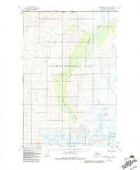
Other maps of this area

1948 · Mt Katmai
USGS Topo · 1:250,000

1951 · Mt Katmai
USGS Topo · 1:250,000

1951 · Afognak C-6
USGS Topo · 1:63,360
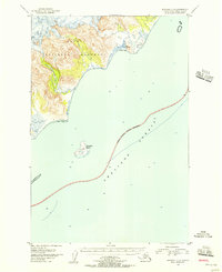
1951 · Afognak C-5
USGS Topo · 1:63,360

1951 · Mount Katmai D-1
USGS Topo · 1:63,360

1951 · Iliamna A-3
USGS Topo · 1:63,360

1951 · Iliamna A-1 and A-2
USGS Topo · 1:63,360

1951 · Mount Katmai C-1
USGS Topo · 1:63,360

1951 · Afognak D-5
USGS Topo · 1:63,360

1951 · Afognak D-6
USGS Topo · 1:63,360