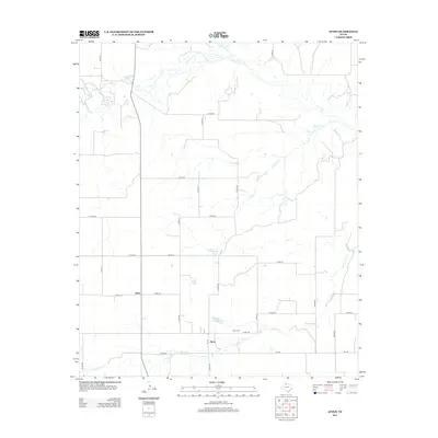
2012 Map of Afton
USGS Topo · Published 2012About this map
Afton and the neighboring community of Glenn anchor this section of Dickens County, where the high plains landscape is defined by a dendritic network of seasonal drainages and springs. The area's hydrology is particularly notable, centered on Patton Springs and the nearby Patton Springs Lake, alongside Roaring Spring to the northwest. These water sources have long been vital landmarks in this arid region, influencing the placement of local ranches and roads. The map documents a strictly rural infrastructure, with a grid of county roads such as Co RD-210 and Co RD-237 connecting isolated farmsteads. Local history is anchored at the Afton Cem, while the winding courses of Cottonwood Cr and Dutchman Cr illustrate the natural erosion patterns across the terrain. This survey provides a clear view of the settlement footprint before further modernization of the local rural road system.
Find a feature on this map
33 named features on this map. Tap any name to fly to it.
Don’t see what you’re looking for? This feature index may not catch every label — zoom into the map to look around manually.
Map Details
Editions of this 2012 Afton Map
This is the sole edition of this map. No revisions or reprints were ever made.
Other maps of this area

1954 · Lubbock
USGS Topo · 1:250,000

1967 · Dickens North
USGS Topo · 1:24,000

1967 · Haystack Mountain
USGS Topo · 1:24,000

1968 · East Afton
USGS Topo · 1:24,000

1968 · Mac Bain
USGS Topo · 1:24,000

1968 · Roaring Springs
USGS Topo · 1:24,000

1968 · Russellville
USGS Topo · 1:24,000

1968 · Rustler Camp
USGS Topo · 1:24,000

1968 · Sanders Hollow
USGS Topo · 1:24,000

1968 · Afton
USGS Topo · 1:24,000