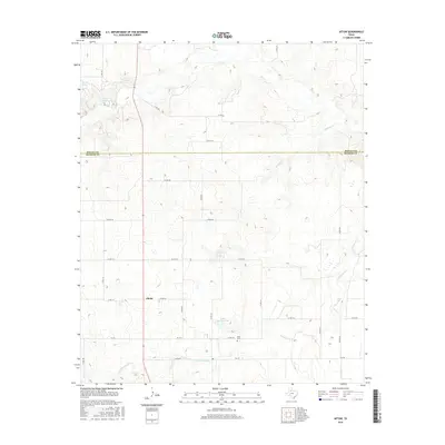
2016 Map of Afton
USGS Topo · Published 2016About this map
Glenn sits at the intersection of local routes in this part of West Texas, where the terrain transitions from the high plains across the Motley Co Dickens Co line. The landscape is defined by its water sources, which historically dictated settlement in this arid region, featuring Roaring Springs and the nearby Roaring Spring in the northwest corner. Further south, the community around Patton Springs and Patton Springs Lake remains a focal point of the local geography. The presence of the Afton Cem near the junction of FM 193 and Co RD 218 offers a specific point of interest for genealogists tracing families from the Afton area. The map also detail various drainages like Fishhole Cr and Cottonwood Cr, which carve through the plains and connect the scattered ranch roads of the county.
Find a feature on this map
33 named features on this map. Tap any name to fly to it.
Don’t see what you’re looking for? This feature index may not catch every label — zoom into the map to look around manually.
Map Details
Editions of this 2016 Afton Map
This is the sole edition of this map. No revisions or reprints were ever made.
Other maps of this area

1954 · Lubbock
USGS Topo · 1:250,000

1967 · Dickens North
USGS Topo · 1:24,000

1967 · Haystack Mountain
USGS Topo · 1:24,000

1968 · East Afton
USGS Topo · 1:24,000

1968 · Mac Bain
USGS Topo · 1:24,000

1968 · Roaring Springs
USGS Topo · 1:24,000

1968 · Russellville
USGS Topo · 1:24,000

1968 · Rustler Camp
USGS Topo · 1:24,000

1968 · Sanders Hollow
USGS Topo · 1:24,000

1968 · Afton
USGS Topo · 1:24,000