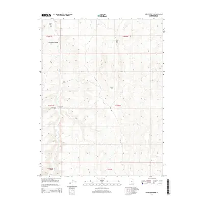
2014 Map of Agency Draw NW
USGS Topo · Published 2014About this map
Fairbanks Crossing anchors the northern portion of this landscape where the waters of Hill Cr navigate through a complex system of high-desert drainage basins. The area is defined by its deep incisions and prominent ridges, most notably Little Pack Mtn which overlooks a network of canyons and draws. The cartography reveals a rugged topography shaped by water erosion, from the narrow corridors of Agency Draw and Green Canyon to the more expansive Johnson Draw. To the south, the terrain becomes increasingly intricate as East Squaw Canyon and West Squaw Draw converge, leading toward the jagged contours of Horsecorn Canyon. This survey provides a precise look at the township and range boundaries of northeastern Utah, documenting the physical landmarks and named geographical features that define this remote corner of Uintah County.
Find a feature on this map
17 named features on this map. Tap any name to fly to it.
Don’t see what you’re looking for? This feature index may not catch every label — zoom into the map to look around manually.
Map Details
Editions of this 2014 Agency Draw NW Map
This is the sole edition of this map. No revisions or reprints were ever made.
Other maps of this area

1885 · East Tavaputs
USGS Topo · 1:250,000

1953 · Nutters Hole
USGS Topo · 1:62,500

1953 · Firewater Canyon
USGS Topo · 1:62,500

1956 · Grand Junction
USGS Topo · 1:250,000

1959 · Grand Junction
USGS Topo · 1:250,000

1960 · Grand Junction
USGS Topo · 1:250,000

1962 · Grand Junction
USGS Topo · 1:250,000

1964 · Grand Junction
USGS Topo · 1:250,000

1965 · Grand Junction
USGS Topo · 1:250,000
1966 · Agency Draw NE
USGS Topo · 1:24,000