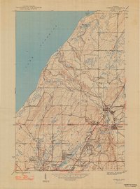
1947 Map of Ahmeek
USGS Topo · Published 1947About this map
The copper mining heritage of the Keweenaw Peninsula is clearly etched across this landscape, where the Ahmeek Mine and Red Jacket Mine anchor a industrial network of shafts and rails. The towns of Ahmeek and Copper City are deeply connected by the Copper Range Railroad and the Calumet and Hecla Railroad, which transported ore from the hills toward the coast. Along the shores of Lake Superior, the terrain shifts from industrial centers to the drainage basins of the Gratiot River and Black Creek. Small residential clusters like Bumbletown, Centennial Heights, and Phillipsville show the concentrated settlement patterns of miners and their families, while local institutions such as Lake Shore Sch and the Ahmeek Cem provide vital points of interest for genealogists tracing ancestors in the Copper Country.
Find a feature on this map
35 named features on this map. Tap any name to fly to it.
Don’t see what you’re looking for? This feature index may not catch every label — zoom into the map to look around manually.
Map Details
Editions of this 1947 Ahmeek Map
2 editions found

Other maps of this area

1915 · Houghton
USGS Topo · 1:62,500

1941 · Ahmeek
USGS Topo · 1:31,680

1941 · Mohawk
USGS Topo · 1:31,680

1946 · Phoenix
USGS Topo · 1:24,000

1946 · Hancock
USGS Topo · 1:24,000

1946 · Mohawk
USGS Topo · 1:24,000

1946 · Muggun Creek
USGS Topo · 1:24,000

1946 · Ahmeek
USGS Topo · 1:24,000

1946 · Laurium
USGS Topo · 1:24,000

1947 · Phoenix
USGS Topo · 1:24,000