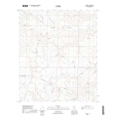
2018 Map of Aimwell
USGS Topo · Published 2018About this map
Aimwell and Sherwood anchor this part of Catahoula Parish, where the terrain transitions from the high points of Chalk Hills and Cassels Hill into a dense network of creek valleys. The landscape is defined by its numerous family and community burial grounds, including Old Spring Ridge Cem and McClendon Cem, which serve as vital markers for local genealogical research. Waterways like Hooter Cr and Sugar Cr carve through the topography, while a complex system of local roads such as Columbia Harrisonburg Rd and Posey-Webb Camp Hwy connect the scattered settlements. The presence of the Aimwell Hunting Club Rd suggests the enduring importance of the surrounding woodlands for local recreation and land use in this rural Louisiana corridor.
Find a feature on this map
51 named features on this map. Tap any name to fly to it.
Don’t see what you’re looking for? This feature index may not catch every label — zoom into the map to look around manually.
Map Details
Editions of this 2018 Aimwell Map
This is the sole edition of this map. No revisions or reprints were ever made.
Other maps of this area

1941 · Manifest
USGS Topo · 1:62,500

1941 · Jena
USGS Topo · 1:62,500

1941 · Harrisonburg
USGS Topo · 1:62,500

1953 · Alexandria
USGS Topo · 1:250,000

1953 · Natchez
USGS Topo · 1:250,000

1955 · Alexandria
USGS Topo · 1:250,000

1955 · Olla
USGS Topo · 1:62,500

1956 · Natchez
USGS Topo · 1:250,000

1958 · Jena
USGS Topo · 1:62,500

1959 · Natchez
USGS Topo · 1:250,000