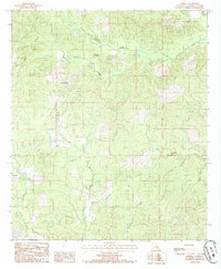
1984 Map of Aimwell
USGS Topo · Published 1985About this map
Aimwell anchors the southwestern portion of this Catahoula Parish survey, marking a pocket of settlement near the winding path of Brushy Creek. The landscape is defined by the Chalk Hills, which rise above a dense network of watercourses that shaped the area's early development and transportation. Smaller communities like Sherwood and Spring Ridge appear as established clusters along the ridgelines and creek valleys.
Find a feature on this map
18 named features on this map. Tap any name to fly to it.
Don’t see what you’re looking for? This feature index may not catch every label — zoom into the map to look around manually.
Map Details
Editions of this 1984 Aimwell Map
This is the sole edition of this map. No revisions or reprints were ever made.
Other maps of this area

1941 · Manifest
USGS Topo · 1:62,500

1941 · Jena
USGS Topo · 1:62,500

1941 · Harrisonburg
USGS Topo · 1:62,500

1953 · Alexandria
USGS Topo · 1:250,000

1953 · Natchez
USGS Topo · 1:250,000

1955 · Alexandria
USGS Topo · 1:250,000

1955 · Olla
USGS Topo · 1:62,500

1956 · Natchez
USGS Topo · 1:250,000

1958 · Jena
USGS Topo · 1:62,500

1959 · Natchez
USGS Topo · 1:250,000