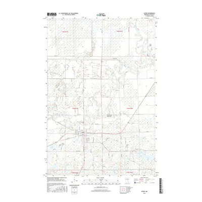
2016 Map of Aitkin
USGS Topo · Published 2016About this map
The town of Aitkin serves as the focal point of this northern Minnesota landscape, situated at a major bend where the Ripple River meets the Mississippi River. The hydrologic complexity of the region is evident in the dense network of meandering waterways, including the Little Willow River, Rice River, and Sissabagamah Cr. These rivers wind through low-lying terrain characterized by numerous wetlands and small basins like Pickerel Lake and Johnson Lake. Outside the municipal center, the land is punctuated by several local burial sites, such as Saint Thomas Cem, Evergreen Cem, and Spencer Cem, which offer significant value for genealogical research in this part of Aitkin County. Transport infrastructure is represented by the Aitkin Municipal Airport-Steve Kurtz Field and a grid of rural routes like Great River Rd and Osprey Ave, which navigate the many oxbows and channels that define this riverine environment.
Find a feature on this map
84 named features on this map. Tap any name to fly to it.
Don’t see what you’re looking for? This feature index may not catch every label — zoom into the map to look around manually.
Map Details
Editions of this 2016 Aitkin Map
This is the sole edition of this map. No revisions or reprints were ever made.
Other maps of this area

1912 · Deerwood
USGS Topo · 1:62,500

1913 · Cuyuna
USGS Topo · 1:62,500

1914 · Deerwood
USGS Topo · 1:62,500

1914 · Aitkin
USGS Topo · 1:62,500

1915 · Aitkin
USGS Topo · 1:62,500

1915 · Cuyuna
USGS Topo · 1:62,500

1916 · Wealthwood
USGS Topo · 1:62,500

1953 · Duluth
USGS Topo · 1:250,000

1958 · Duluth
USGS Topo · 1:250,000

1973 · Iron Hub
USGS Topo · 1:24,000