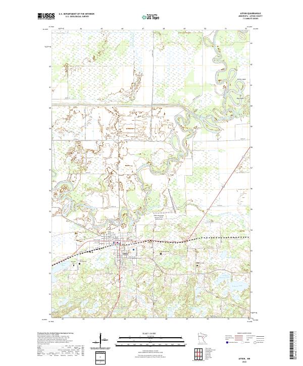
2022 Map of Aitkin
USGS Topo · Published 2022About this map
The Aitkin settlement serves as the focal point of this northern Minnesota landscape, situated where the Ripple River meets the Mississippi River. This modern survey illustrates the complex hydrology of the region, featuring the meandering paths of the Rice River and Little Willow River as they thread through extensive wetlands and small lakes like Pickerel Lake and Hanson Lake. The town's infrastructure is anchored by the Aitkin County Courthouse and the Aitkin Municipal Airport-Steve Kurtz Field, while the Cuyuna Lakes State Trl follows the old rail corridor through the heart of the community. Local heritage is preserved in the grounds of Evergreen Cem, Saint Thomas Cem, and Spencer Cem, which are clearly marked alongside the modern road network of Co HWY 41 and the Great River Rd.
Find a feature on this map
61 named features on this map. Tap any name to fly to it.
Don’t see what you’re looking for? This feature index may not catch every label — zoom into the map to look around manually.
Map Details
Editions of this 2022 Aitkin Map
This is the sole edition of this map. No revisions or reprints were ever made.
Other maps of this area

1912 · Deerwood
USGS Topo · 1:62,500

1913 · Cuyuna
USGS Topo · 1:62,500

1914 · Deerwood
USGS Topo · 1:62,500

1914 · Aitkin
USGS Topo · 1:62,500

1915 · Aitkin
USGS Topo · 1:62,500

1915 · Cuyuna
USGS Topo · 1:62,500

1916 · Wealthwood
USGS Topo · 1:62,500

1953 · Duluth
USGS Topo · 1:250,000

1958 · Duluth
USGS Topo · 1:250,000

1973 · Iron Hub
USGS Topo · 1:24,000