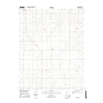
2016 Map of Alameda
USGS Topo · Published 2016About this map
The S Fork Ninnescah River anchors the northeastern corner of this agricultural landscape in Kingman County, where the sprawling grid of section roads meets a network of wandering creeks. Small settlements like Alameda and Basil serve as local landmarks along the transit corridor of S State Rd 14. The terrain is defined by its water management and drainage, featuring several named bodies of water including Christopher Lake, Mann Lake, and Johnson Lake. For those tracing local heritage, the map identifies small, isolated burial sites such as Bethany Cem and Hunt Cem, which provide specific points of interest for genealogists. The land is drained by numerous named tributaries, such as Rose Bud Cr, Blue Stem Cr, and Negro Cr, illustrating the complex hydrology that supports the surrounding farm tracts.
Find a feature on this map
43 named features on this map. Tap any name to fly to it.
Don’t see what you’re looking for? This feature index may not catch every label — zoom into the map to look around manually.
Map Details
Editions of this 2016 Alameda Map
This is the sole edition of this map. No revisions or reprints were ever made.
Other maps of this area

1889 · Anthony
USGS Topo · 1:125,000

1889 · Cheney
USGS Topo · 1:125,000

1889 · Caldwell
USGS Topo · 1:125,000

1891 · Cheney
USGS Topo · 1:125,000

1891 · Anthony
USGS Topo · 1:125,000

1892 · Kingman
USGS Topo · 1:125,000

1893 · Caldwell
USGS Topo · 1:125,000

1894 · Kingman
USGS Topo · 1:125,000

1897 · Caldwell
USGS Topo · 1:125,000

1901 · Cheney
USGS Topo · 1:125,000