2022 Map of Alamo
USGS Topo · Published 2022About this map
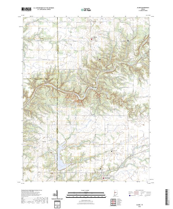
Alamo sits at the northern end of this landscape, characterized by the deeply incised drainage of Sugar Creek, which carves through the central portion of the quadrangle. This natural corridor is marked by distinctive geological features such as Devils Backbone and Pedestal Rock, while the presence of Deer Mill and Sycamore Ford along the waterway speaks to historical river crossings and early industry. To the south, the settlement of Waveland borders the expansive Lake Waveland, which is fed by Demeree Creek and Old Shoe Branch. The map preserves numerous genealogical landmarks, including Maple Ridge Cem, Sparks Cem, and Old Union Cem, scattered across the undulating terrain of Fountain, Montgomery, and Parke Counties. A network of hiking paths, such as Back Pack Trl and Trail #7 Trl, winds through the wooded breaks near the creek, illustrating the area's modern role as a site for outdoor recreation amidst its historical farming and milling roots.
Find a feature on this map
101 named features on this map. Tap any name to fly to it.
Don’t see what you’re looking for? This feature index may not catch every label — zoom into the map to look around manually.
Map Details
Editions of this 2022 Alamo Map
This is the sole edition of this map. No revisions or reprints were ever made.
Historical Maps of Byron Through Time
3 maps found