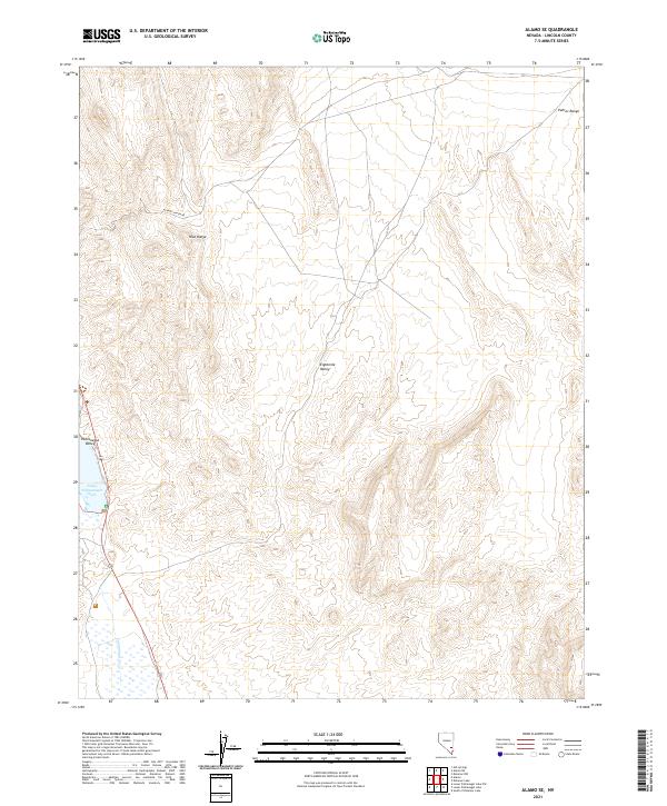
2021 Map of Alamo SE
USGS Topo · Published 2021About this map
Pahranagat Valley dominates the southwestern portion of this Lincoln County survey, where the waters of Upper Pahranagat Lake and the intermittent flow of Pahranagat Cr define the local ecology. This arid landscape is sharply partitioned by the Hiko Range and the Pahroc Range, which flank the high-desert basins of the interior. The presence of Alamo Canyon Rd provides a primary corridor through this basin-and-range topography, connecting the valley floor to the more isolated Eightmile Valley. The map reflects the enduring cadastral framework of the Public Land Survey System, with township and range lines such as t7s r61e and t8s r62e marking out the grid of this sparsely populated desert expanse.
Find a feature on this map
11 named features on this map. Tap any name to fly to it.
Don’t see what you’re looking for? This feature index may not catch every label — zoom into the map to look around manually.
Map Details
Editions of this 2021 Alamo SE Map
This is the sole edition of this map. No revisions or reprints were ever made.
Other maps of this area

1885 · Pioche
USGS Topo · 1:250,000

1886 · Pioche
USGS Topo · 1:250,000

1945 · Alamo
USGS Topo · 1:125,000

1954 · Caliente
USGS Topo · 1:250,000

1959 · Caliente
USGS Topo · 1:250,000

1969 · Alamo SE
USGS Topo · 1:24,000

1969 · Lower Pahranagat Lake
USGS Topo · 1:24,000

1969 · Alamo NE
USGS Topo · 1:24,000
1969 · Lower Pahranagat Lake NW
USGS Topo · 1:24,000
1969 · Delamar 3 NW
USGS Topo · 1:24,000