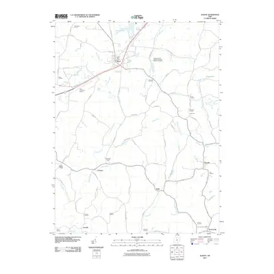
2010 Map of Albany
USGS Topo · Published 2010About this map
Lake Snowden and the surrounding hills of Athens County define this 2010 landscape, where small rural communities are connected by a network of winding county roads. The village of Albany serves as a central hub, home to the Albany Post Office and situated near the Ohio University Airport. Further south, the map reveals a pattern of dispersed settlements such as Carpenter, Welsh, and Harrisonville, each tied to the local topography and the headwaters of several drainages, including Leading Creek and the West Branch Shade River.
Find a feature on this map
76 named features on this map. Tap any name to fly to it.
Don’t see what you’re looking for? This feature index may not catch every label — zoom into the map to look around manually.
Map Details
Editions of this 2010 Albany Map
This is the sole edition of this map. No revisions or reprints were ever made.
Other maps of this area

1903 · Athens
USGS Topo · 1:62,500

1904 · Zaleski
USGS Topo · 1:62,500

1905 · Athens
USGS Topo · 1:62,500

1905 · Wilkesville
USGS Topo · 1:62,500

1907 · Pomeroy
USGS Topo · 1:62,500

1907 · Zaleski
USGS Topo · 1:62,500

1908 · Wilkesville
USGS Topo · 1:62,500

1947 · Columbus
USGS Topo · 1:250,000

1960 · Albany
USGS Topo · 1:24,000

1960 · Rutland
USGS Topo · 1:24,000