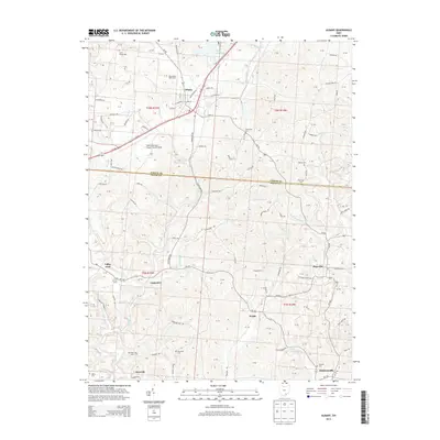
2013 Map of Albany
USGS Topo · Published 2013About this map
Albany and the surrounding rural townships of Athens Co and Meigs Co are defined by a complex network of ridgeline roads and winding creek valleys. The landscape is dotted with ancestral burial grounds such as Town House Cem, Rawlings Cem, and Martin Cem, providing essential points of interest for those tracing local family lineages. The presence of Ohio University Airport-Snyder Field and the Boyd Allen Dairy Farm north of town illustrates the varied land use of the region, ranging from educational infrastructure to traditional agriculture.
Find a feature on this map
145 named features on this map. Tap any name to fly to it.
Don’t see what you’re looking for? This feature index may not catch every label — zoom into the map to look around manually.
Map Details
Editions of this 2013 Albany Map
This is the sole edition of this map. No revisions or reprints were ever made.
Other maps of this area

1903 · Athens
USGS Topo · 1:62,500

1904 · Zaleski
USGS Topo · 1:62,500

1905 · Athens
USGS Topo · 1:62,500

1905 · Wilkesville
USGS Topo · 1:62,500

1907 · Pomeroy
USGS Topo · 1:62,500

1907 · Zaleski
USGS Topo · 1:62,500

1908 · Wilkesville
USGS Topo · 1:62,500

1947 · Columbus
USGS Topo · 1:250,000

1960 · Albany
USGS Topo · 1:24,000

1960 · Rutland
USGS Topo · 1:24,000