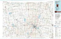
1985 Map of Albert Lea
USGS Topo · Published 1994About this map
The city of Albert Lea serves as a central hub in this Southern Minnesota landscape, where an extensive network of water and rail shaped the region's development. Situated at the junction of the Chicago and North Western and the Chicago Milwaukee St Paul and Pacific railroads, the area showcases the transition from heavy rail dependence to modern infrastructure, noted by segments of Old Railroad Grade. To the east, Austin marks the edge of the sheet, while smaller agricultural centers like Hollandale, Blooming Prairie, and Ellendale anchor the surrounding townships.
Find a feature on this map
145 named features on this map. Tap any name to fly to it.
Don’t see what you’re looking for? This feature index may not catch every label — zoom into the map to look around manually.
Map Details
Editions of this 1985 Albert Lea Map
2 editions found
Other maps of this area

1950 · Mankato East
USGS Topo · 1:62,500

1951 · Mankato East
USGS Topo · 1:62,500

1951 · Mankato West
USGS Topo · 1:62,500

1953 · Saint Paul
USGS Topo · 1:250,000

1953 · New Ulm
USGS Topo · 1:250,000

1954 · Albert Lea
USGS Topo · 1:62,500

1954 · Hayward
USGS Topo · 1:62,500

1954 · Austin
USGS Topo · 1:62,500

1954 · Fairmont
USGS Topo · 1:250,000

1954 · Mason City
USGS Topo · 1:250,000