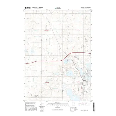
2016 Map of Albert Lea West
USGS Topo · Published 2016About this map
Albert Lea anchor the southeastern corner of this Freeborn County landscape, where the city's residential streets and cemeteries meet a complex network of glacial lakes and managed drainage. The terrain is defined by a dense system of agricultural ditches, including County Ditch Number Eleven and Judicial Ditch Number Five, which connect numerous bodies of water such as School Section Lake and White Lake. These waterways trace the engineering efforts required to reclaim the wet prairie for farming, a process that shaped the growth of nearby settlements like Manchester and Armstrong.
Find a feature on this map
62 named features on this map. Tap any name to fly to it.
Don’t see what you’re looking for? This feature index may not catch every label — zoom into the map to look around manually.
Map Details
Editions of this 2016 Albert Lea West Map
This is the sole edition of this map. No revisions or reprints were ever made.
Other maps of this area

1954 · Albert Lea
USGS Topo · 1:62,500

1954 · Mason City
USGS Topo · 1:250,000

1955 · Wells
USGS Topo · 1:62,500

1957 · Mason City
USGS Topo · 1:250,000

1958 · Mason City
USGS Topo · 1:250,000

1967 · Freeborn
USGS Topo · 1:24,000

1967 · Hartland
USGS Topo · 1:24,000

1967 · Ellendale
USGS Topo · 1:24,000

1982 · Albert Lea West
USGS Topo · 1:24,000
1982 · Emmons
USGS Topo · 1:24,000