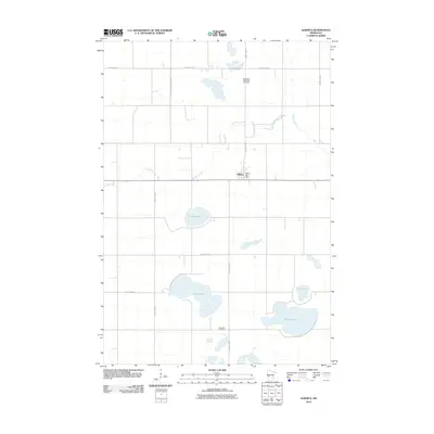
2010 Map of Alberta
USGS Topo · Published 2010About this map
The settlement of Alberta anchors this survey of central Stevens County, where the agricultural grid is interrupted by a significant chain of glacial lakes and prairie wetlands. The landscape is defined by the meandering course of Muddy Creek, which flows through the northern and central sections, and several substantial water bodies including Lake Hattie, Gorder Lake, and Clear Lake. For local historians, the map identifies specific community landmarks such as the Alberta Post Office and two distinct burial grounds: the Pepperton Methodist Cemetery in the north and the Frog Lake Cemetery to the south. The transportation network is built upon a system of county highways, including County Hwy-9 and County Hwy-14, which facilitate the movement of goods through this productive prairie region.
Find a feature on this map
15 named features on this map. Tap any name to fly to it.
Don’t see what you’re looking for? This feature index may not catch every label — zoom into the map to look around manually.
Map Details
Editions of this 2010 Alberta Map
This is the sole edition of this map. No revisions or reprints were ever made.
Other maps of this area

1910 · Chokio
USGS Topo · 1:62,500

1912 · Chokio
USGS Topo · 1:62,500

1912 · Morris
USGS Topo · 1:62,500

1953 · Milbank
USGS Topo · 1:250,000

1953 · Saint Cloud
USGS Topo · 1:250,000

1957 · Saint Cloud
USGS Topo · 1:250,000

1958 · Milbank
USGS Topo · 1:250,000

1958 · Saint Cloud
USGS Topo · 1:250,000

1968 · Dry Wood Lake
USGS Topo · 1:24,000

1968 · Artichoke Lake NW
USGS Topo · 1:24,000