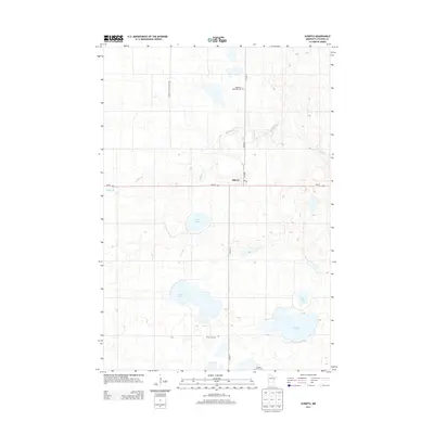
2013 Map of Alberta
USGS Topo · Published 2013About this map
Alberta serves as the central hub of this Stevens County landscape, situated where MN-28 intersects with Main St. The town is anchored by its Po, reflecting a classic prairie settlement pattern organized around the highway and local maintenance routes like Hiniman Maintenance Rd. The surrounding terrain is defined by a dense network of glacial prairie potholes and larger water bodies, including the expansive Lake Hattie, Clear Lake, and the aptly named Flax Lake and Gorder Lake.
Find a feature on this map
15 named features on this map. Tap any name to fly to it.
Don’t see what you’re looking for? This feature index may not catch every label — zoom into the map to look around manually.
Map Details
Editions of this 2013 Alberta Map
This is the sole edition of this map. No revisions or reprints were ever made.
Other maps of this area

1910 · Chokio
USGS Topo · 1:62,500

1912 · Chokio
USGS Topo · 1:62,500

1912 · Morris
USGS Topo · 1:62,500

1953 · Milbank
USGS Topo · 1:250,000

1953 · Saint Cloud
USGS Topo · 1:250,000

1957 · Saint Cloud
USGS Topo · 1:250,000

1958 · Milbank
USGS Topo · 1:250,000

1958 · Saint Cloud
USGS Topo · 1:250,000

1968 · Dry Wood Lake
USGS Topo · 1:24,000

1968 · Artichoke Lake NW
USGS Topo · 1:24,000