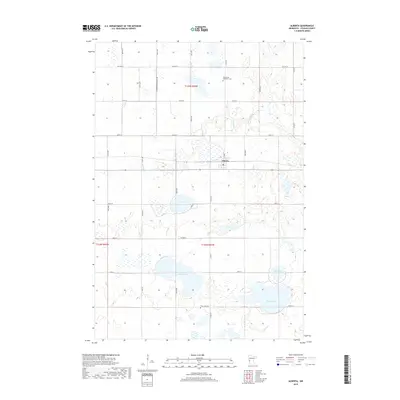
2019 Map of Alberta
USGS Topo · Published 2019About this map
Alberta serves as the primary settlement center in this portion of Stevens County, situated at the junction of CO Hwy 9 and CO Rd 66. The landscape is defined by its glacial prairie potholes and significant water bodies, including the centrally located Clear Lake, the large Lake Hattie to the south, and Gorder Lake in the southeast corner. These lakes and smaller marshes are connected by a network of drainage features like Muddy Creek, which winds through the eastern sections. Genealogists will find notable burial sites in the rural sections surrounding the town, specifically the Pepperton Methodist Cem in the north and the Frog Lake Cem near the southern boundary. The survey illustrates a highly organized township grid with numerous secondary routes such as 570th Ave and 240th St providing access to the fertile agricultural lands between the many wetlands.
Find a feature on this map
34 named features on this map. Tap any name to fly to it.
Don’t see what you’re looking for? This feature index may not catch every label — zoom into the map to look around manually.
Map Details
Editions of this 2019 Alberta Map
This is the sole edition of this map. No revisions or reprints were ever made.
Other maps of this area

1910 · Chokio
USGS Topo · 1:62,500

1912 · Chokio
USGS Topo · 1:62,500

1912 · Morris
USGS Topo · 1:62,500

1953 · Milbank
USGS Topo · 1:250,000

1953 · Saint Cloud
USGS Topo · 1:250,000

1957 · Saint Cloud
USGS Topo · 1:250,000

1958 · Milbank
USGS Topo · 1:250,000

1958 · Saint Cloud
USGS Topo · 1:250,000

1968 · Dry Wood Lake
USGS Topo · 1:24,000

1968 · Artichoke Lake NW
USGS Topo · 1:24,000