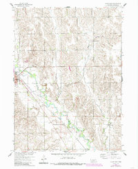
1958 Map of Albion East
USGS Topo · Published 1985About this map
Albion stands as the primary hub on the western edge of this Nebraska landscape, where the Union Pacific Railroad cuts a diagonal path across the agricultural plains. The terrain is defined by the broad O'Neill Valley and the winding courses of Beaver Creek and Vorhees Creek. This 1958 field-checked record, with later 1980s updates, captures a rural infrastructure of one-room schoolhouses like School No 7 and School No 49, alongside the legacy of former transit routes preserved as an Old Railroad Grade. For those tracing family histories in Boone County, the map provides precise locations for the St Michael Cem, Albion Cem, and Boone Cem, grounding the community's genealogical record in the physical geography of the mid-20th century prairie.
Find a feature on this map
12 named features on this map. Tap any name to fly to it.
Don’t see what you’re looking for? This feature index may not catch every label — zoom into the map to look around manually.
Map Details
Editions of this 1958 Albion East Map
2 editions found
Other maps of this area

1954 · Albion West
USGS Topo · 1:24,000

1954 · Cedar Rapids SE
USGS Topo · 1:24,000

1955 · Broken Bow
USGS Topo · 1:250,000

1955 · Fremont
USGS Topo · 1:250,000

1956 · Broken Bow
USGS Topo · 1:250,000

1957 · Fremont
USGS Topo · 1:250,000

1958 · Fremont
USGS Topo · 1:250,000

1958 · St. Edward
USGS Topo · 1:24,000

1958 · Albion East
USGS Topo · 1:24,000
1958 · St. Edward SW
USGS Topo · 1:24,000