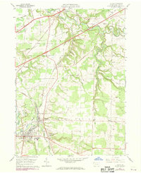
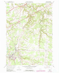
1959 Map of Albion
USGS Topo · Published 1970About this map
The Bessemer and Lake Erie and Penn Central railroads dominate the landscape of western Erie County, reflecting the region's industrial and transportation legacy. These lines connect the manufacturing and agricultural centers of Albion and Cranesville, where a dense network of local streets gives way to the more rural surrounding townships. Near Lundys Lane, the presence of Elk Creek Sch and Northwestern High Sch highlights the area's mid-century civic development.
Find a feature on this map
46 named features on this map. Tap any name to fly to it.
Don’t see what you’re looking for? This feature index may not catch every label — zoom into the map to look around manually.
Map Details
Editions of this 1959 Albion Map
5 editions found
Other maps of this area

1899 · Erie
USGS Topo · 1:62,500

1900 · Girard
USGS Topo · 1:62,500

1900 · Erie
USGS Topo · 1:62,500

1900 · Fairview
USGS Topo · 1:62,500

1923 · Cambridge Springs
USGS Topo · 1:62,500

1925 · Cambridge Springs
USGS Topo · 1:62,500

1943 · Cambridge Springs
USGS Topo · 1:62,500

1950 · Cleveland
USGS Topo · 1:250,000

1950 · Erie
USGS Topo · 1:250,000

1956 · Cleveland
USGS Topo · 1:250,000