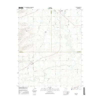
2016 Map of Albion
USGS Topo · Published 2016About this map
The Kiamichi River flows through the southern portion of this region, providing a natural corridor for the settlement of Albion and the surrounding valley. In the north, the terrain transitions into the distinct topography of the Potato Hills, a notable geologic feature that overlooks the community of Talihina. This area is marked by a high density of family and community burial grounds, including the Armstrong Cem, McIntosh Cem, and Noah Cem, which offer significant touchpoints for genealogical research and local history. The map also documents the modern infrastructure of the Talihina Municipal Airport and water management features like Martha Lingenfelter Lake and the Rock Cr Site 1 Reservoir. The convergence of Latimer, Le Flore, and Pushmataha counties occurs here, illustrating how these administrative boundaries intersect with the natural flow of Rock Creek and Prairie Cr.
Find a feature on this map
74 named features on this map. Tap any name to fly to it.
Don’t see what you’re looking for? This feature index may not catch every label — zoom into the map to look around manually.
Map Details
Editions of this 2016 Albion Map
This is the sole edition of this map. No revisions or reprints were ever made.
Other maps of this area

1900 · Winding Stair
USGS Topo · 1:125,000

1901 · Tuskahoma
USGS Topo · 1:125,000

1908 · Tuskahoma
USGS Topo · 1:125,000

1909 · Tuskahoma
USGS Topo · 1:125,000

1909 · Winding Stair
USGS Topo · 1:125,000

1940 · Red Oak
USGS Topo · 1:62,500

1943 · Red Oak
USGS Topo · 1:62,500

1950 · Mcalester
USGS Topo · 1:250,000

1962 · McAlester
USGS Topo · 1:250,000

1965 · McAlester
USGS Topo · 1:250,000