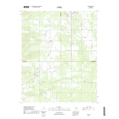
2019 Map of Albion
USGS Topo · Published 2019About this map
Talihina and Albion anchor this corner of southeastern Oklahoma, where the Kiamichi Valley meets the southern edge of the Potato Hills. The terrain is defined by the winding course of the Kiamichi River, which flows through the southern portion of the sheet, and the rugged rise of Blackjack Ridge. Settlement patterns are traced through a dense network of local roads and several family or community burial grounds, including Old Talihina Cem and McIntosh Cem. Transportation infrastructure centers on the Talihina Municipal Airport and the highways connecting these rural communities. The landscape is a mix of wooded slopes and open valleys, drained by numerous creeks like Clear Cr and Rock Creek. This survey captures the rural character of the region, showing how the local economy and geography are tied to the river and the surrounding hill country.
Find a feature on this map
76 named features on this map. Tap any name to fly to it.
Don’t see what you’re looking for? This feature index may not catch every label — zoom into the map to look around manually.
Map Details
Editions of this 2019 Albion Map
This is the sole edition of this map. No revisions or reprints were ever made.
Other maps of this area

1900 · Winding Stair
USGS Topo · 1:125,000

1901 · Tuskahoma
USGS Topo · 1:125,000

1908 · Tuskahoma
USGS Topo · 1:125,000

1909 · Tuskahoma
USGS Topo · 1:125,000

1909 · Winding Stair
USGS Topo · 1:125,000

1940 · Red Oak
USGS Topo · 1:62,500

1943 · Red Oak
USGS Topo · 1:62,500

1950 · Mcalester
USGS Topo · 1:250,000

1962 · McAlester
USGS Topo · 1:250,000

1965 · McAlester
USGS Topo · 1:250,000