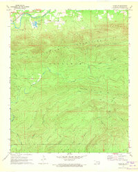
1971 Map of Albion SW
USGS Topo · Published 1973About this map
The Kiamichi River valley serves as the primary corridor for movement and industry in this portion of Pushmataha County, where the St Louis-San Francisco railroad tracks run parallel to the water. This lowland area is home to the specialized Kiamichi Fish Farm and contains a documented grave near the northern boundary. South of the river, the landscape rises sharply into the dominant Kiamichi Mountains and Tuskahoma Mountains, a heavily dissected upland region defined by deep drainages like Black Fork and Cripple Creek.
Find a feature on this map
23 named features on this map. Tap any name to fly to it.
Don’t see what you’re looking for? This feature index may not catch every label — zoom into the map to look around manually.
Map Details
Editions of this 1971 Albion SW Map
This is the sole edition of this map. No revisions or reprints were ever made.
Other maps of this area

1901 · Tuskahoma
USGS Topo · 1:125,000

1901 · Alikchi
USGS Topo · 1:125,000

1908 · Tuskahoma
USGS Topo · 1:125,000

1909 · Tuskahoma
USGS Topo · 1:125,000

1950 · Mcalester
USGS Topo · 1:250,000

1962 · McAlester
USGS Topo · 1:250,000

1965 · McAlester
USGS Topo · 1:250,000

1971 · Yanush
USGS Topo · 1:24,000
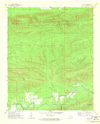
1971 · Albion SE
USGS Topo · 1:24,000

1971 · Kiamichi
USGS Topo · 1:24,000