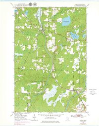
1953 Map of Alborn
USGS Topo · Published 1979About this map
Duluth Missabe And Iron Range tracks through the heart of St. Louis County, anchoring the timber and transit landscape of the early 1950s. The settlement of Alborn serves as a central hub, where the rail line meets Coleraine Junction and branches through heavy wetlands and forest. The mapping reveals a distributed network of small rural communities and civic life, evidenced by the Town Hall in New Independence and several scattered houses of worship such as Bethlehem Ch and Industrial Ch. Numerous small burial grounds, including Spruce Hill Cem and the Indian Cem, offer specific points of interest for genealogists tracking family roots in the northern woods. The terrain is defined by its complex drainage, where the Artichoke River connects Artichoke Lake to a series of smaller water bodies like Schelin Lake and Levindusky Lake.
Find a feature on this map
30 named features on this map. Tap any name to fly to it.
Don’t see what you’re looking for? This feature index may not catch every label — zoom into the map to look around manually.
Map Details
Editions of this 1953 Alborn Map
3 editions found
Other maps of this area

1953 · Canyon
USGS Topo · 1:24,000

1953 · Saginaw
USGS Topo · 1:24,000

1953 · Payne
USGS Topo · 1:24,000

1953 · Alborn
USGS Topo · 1:24,000

1953 · Brookston
USGS Topo · 1:24,000

1953 · Independence
USGS Topo · 1:24,000

1953 · Brookston NW
USGS Topo · 1:24,000

1953 · Duluth
USGS Topo · 1:250,000

1954 · Martin Lake
USGS Topo · 1:24,000

1954 · Hibbing
USGS Topo · 1:250,000