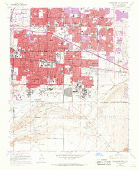
1960 Map of Albuquerque East
USGS Topo · Published 1969About this map
Albuquerque undergoes a significant mid-century transition on this sheet, where the expanding urban grid of the Town of Albuquerque meets the desert terrain to the east. The 1967 photorevisions, marked in purple, illustrate a rapid eastward push of residential developments like Vista Encantada and Hoffman Town toward the foothills of the Sandia Mountains. This growth is anchored by major institutional and federal footprints, including the University of New Mexico, the State Fairgrounds, and the massive complex of Kirtland Air Force Base and the Sandia Military Reservation. South of Central Avenue, the landscape remains dominated by aviation and military infrastructure near the Municipal Airport. The map traces a network of neighborhood schools and churches, such as Pius X High Sch and Queen of Heaven Ch, which served the burgeoning post-war population as it moved into the heights above the valley.
Find a feature on this map
100 named features on this map. Tap any name to fly to it.
Don’t see what you’re looking for? This feature index may not catch every label — zoom into the map to look around manually.
Map Details
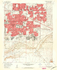
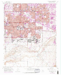
Editions of this 1960 Albuquerque East Map
Other maps of this area

1888 · Bernalillo
USGS Topo · 1:125,000

1889 · Albuquerque
USGS Topo · 1:125,000

1892 · San Pedro
USGS Topo · 1:125,000

1893 · Albuquerque
USGS Topo · 1:125,000

1917 · Estancia
USGS Topo · 1:125,000

1934 · Alameda
USGS Topo · 1:24,000

1934 · West Albuquerque
USGS Topo · 1:24,000

1934 · Griegos
USGS Topo · 1:24,000

1934 · East Albuquerque
USGS Topo · 1:24,000

1938 · Albuquerque
USGS Topo · 1:62,500
Featured Places
- Albuquerque, NM
- Oñate, Albuquerque
- La Mesa, Albuquerque
- Juan Tabo Hills, Albuquerque
- Manzano Manor, Albuquerque