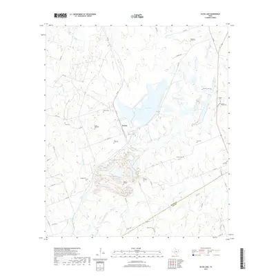
2019 Map of Alcoa Lake
USGS Topo · Published 2019About this map
Sandow and the industrial landscape of the Alcoa Lake reservoir dominate this part of Central Texas, where the local economy and topography were reshaped by large-scale mining and resource management. The area shows a high density of rural burial grounds, likely reflecting established family plots and early church communities that predated the industrial shifts. Genealogists will find a wealth of information in the numerous documented sites including Pleasant Hill Cem, Bingham Cem, and the Hamilton Chapel Cem near the northern boundary. The terrain is defined by the winding paths of E Yegua Cr and Rocky Cr, which cut through the landscape alongside a network of county roads such as Co RD 447 and FM 1786. The boundary between Milam Co and Lee Co is visible to the south near Beulah Cem, marking a clear division in this largely rural and resource-focused region.
Find a feature on this map
54 named features on this map. Tap any name to fly to it.
Don’t see what you’re looking for? This feature index may not catch every label — zoom into the map to look around manually.
Map Details
Editions of this 2019 Alcoa Lake Map
This is the sole edition of this map. No revisions or reprints were ever made.
Other maps of this area

1885 · Taylor
USGS Topo · 1:125,000

1885 · Bastrop
USGS Topo · 1:125,000

1887 · Taylor
USGS Topo · 1:125,000

1893 · Bastrop
USGS Topo · 1:125,000

1894 · Taylor
USGS Topo · 1:125,000

1904 · Bastrop
USGS Topo · 1:125,000

1919 · Dime Box
USGS Topo · 1:62,500

1948 · Lexington
USGS Topo · 1:62,500

1950 · Lexington
USGS Topo · 1:62,500

1954 · Austin
USGS Topo · 1:250,000